Related project
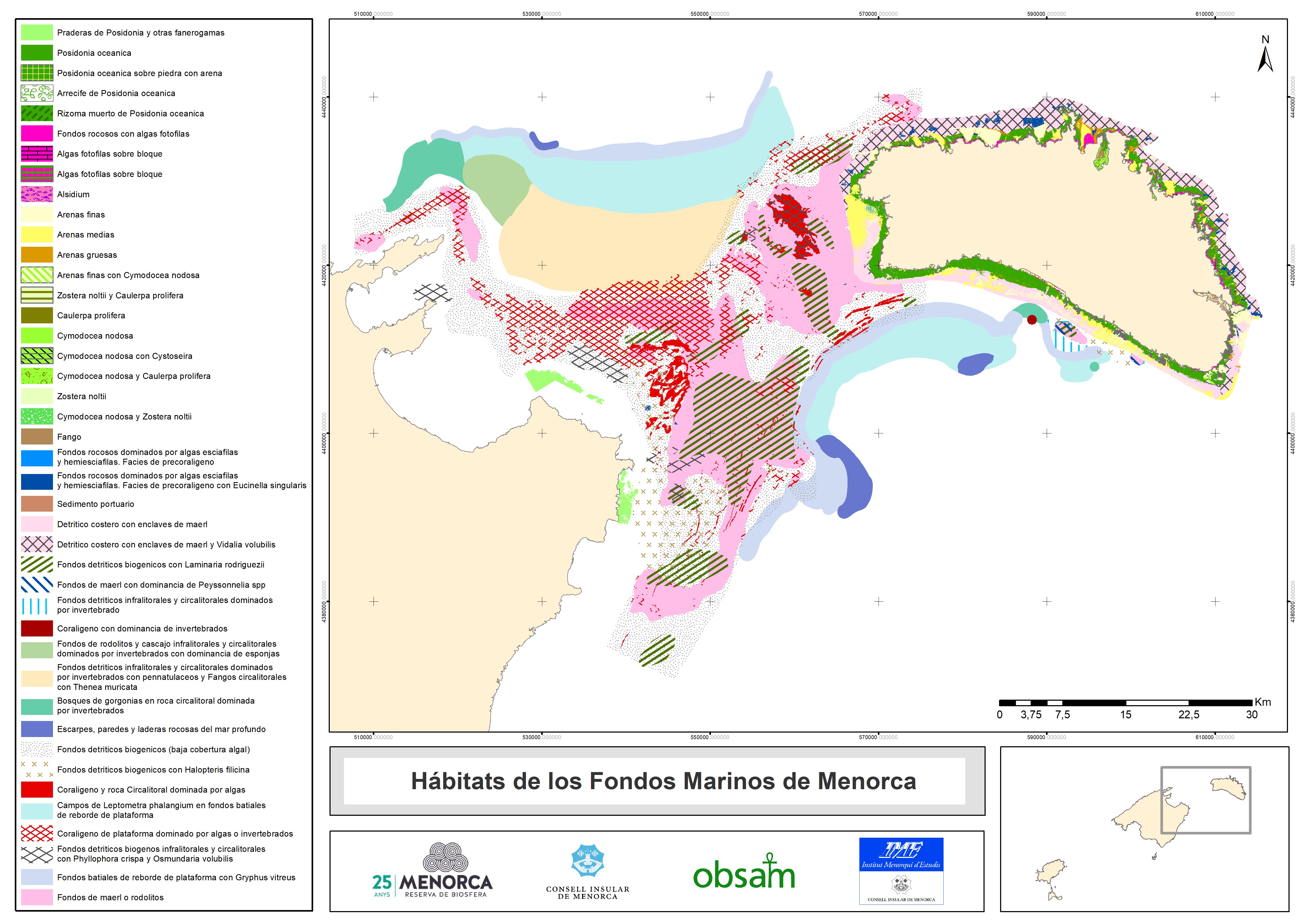
The aim of the project to compile of maps of the marine and coastal habitats of the Balearic Isles is to calculate the size of the habitats and assess their state of conservation. The project’s other key points are:
- Organise the maps in a system based on coordinates and classification
- To detect where there are gaps in information or poor quality information that could be improved
- Calculate the size of the various habitats for each island in accordance with the information that has been compiled and processed.
Understanding the enormous diversity of landscapes under the sea and their state of conservation is essential for improving management.
Marilles donates €30,000
The project will be developed by the Institut Menorquí d’Estudis (IME) via the Observatori Socioambiental de Menorca (OBSAM) and the Societat d’Història Natural de les Balears (SHNB). As well as collecting existing information, specialists will carry out fieldwork to obtain new cartographic information.
“Fish and other organisms are not randomly distributed but rather in a manner propitious to their habitats. Understanding and conserving these habitats is a fundamental part of preserving marine life.” David Carreras, director of OBSAM.
First step in a more ambitious project
The compilation of marine maps should be seen as the initial activity within a broader project to assess the marine and coastal capital of the Balearic Islands. Marilles, in conjunction with the British consultancy EFTEC and the Universitat de les Illes Balears, has begun to establish the basis for an accounting system for the natural marine capital that will make clear the links between the changes in the marine environment and the economic impact this implies for each sector.
“Our economic and welfare system depends on the environment being in good condition. In some islands, the sea and marine habitats play an even more important role.” Aniol Esteban, director of the Marilles Foundation.


